XY- or Z-coordinate correction with either triangle model or point grid file. Triangle model can be used to modify point heights and grid files to modify either XY-coordinate or point height. Behavior depenends on given files.
If only one triangle model file is given, it is used to modify point heights. The point height value is modified by the model height calculated at the point position.
If only one point file containing points in equal size grid is given, it is used to modify point heights. The point height value is modified by value calculated from the heights of the nearest grid point heights weighted by the distance to the point.
If two point files containing points in equal size grid is given, it is used to modify point XY-coordinates. Both X- and Y-coordinates have their own conversion files and the coordinate value is modified by value calculated from the heights of the nearest grid point heights weighted by the distance to the point.
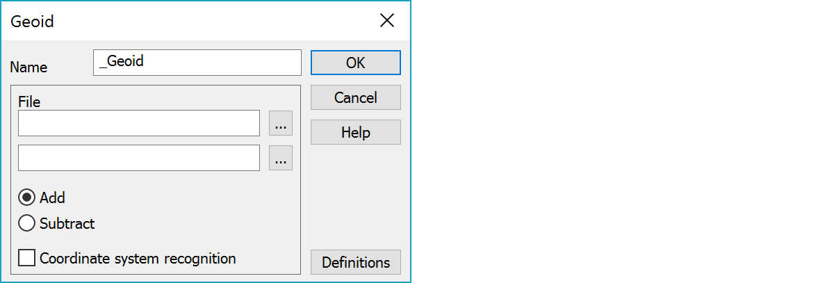
Function name.
Triangle model or grid point files in 3D-binary format.
Coordinate Z change direction: either adds model height to Z or subtracts it.
Tries to recognize both the transformed point and the geoid file coordinate systems from their easting coordinate. If both systems are recognized, coordinate system transformations are automatically made before and after actual geoid transformation. Recognizes WGS84-, TM35-, KKJ- and GK-systems.
Definitions common for all functions.